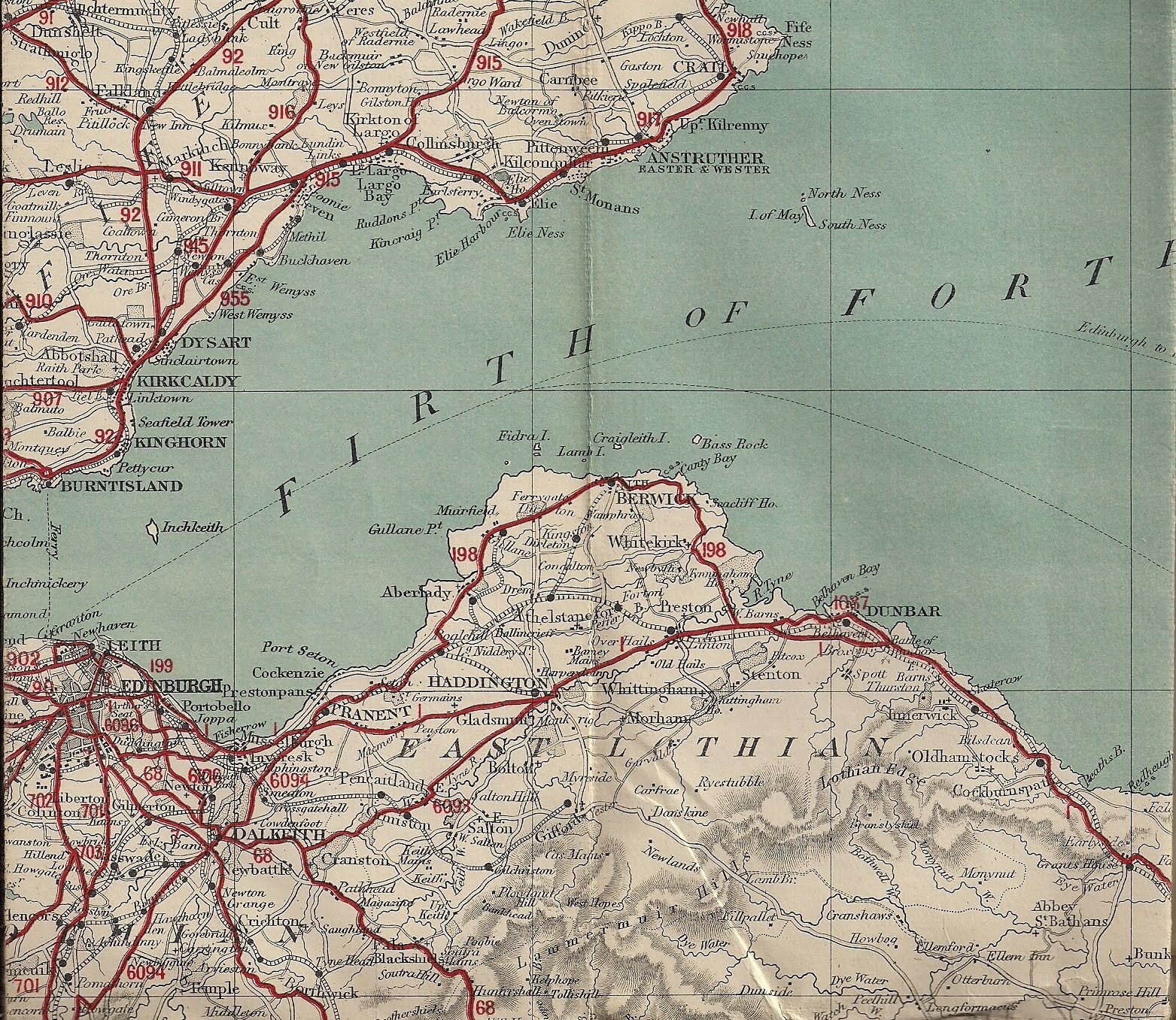
Am I the only one who finds old maps fascinating? Shown here is a map of the South of Scotland, concentrating on Edinburgh and the Firth of Forth, but the date is difficult to establish. At 3/- a copy, (that's three shillings to young folks, OK, that's 15 pence to you very young folks), and 'cloth bound,' it was designed for those rich enough to possess a motor car which enabled the middle classes to join the toffs driving around the country. Such driving became popular in the 1920's and with cars (That's 'automobiles' to those in North America) being so expensive the working classes, who often drove lorries and vans for employment, could never hope to obtain a car of their own. Indeed in was only in the late fifties and early sixties that car ownership really became a possibility.
I love looking at such maps and pondering their date, and indeed the owners over the years. It is stupidly interesting to look at a map of the district from days of yore and compare them to the present day. For no good reason I can be excited by the residue of ancient pathways, buildings and workplaces that no longer exist in a manner that I cannot repeat for the buildings of today. Why this should be I cannot say, but there it is! There is of course a demand for these maps, they sell on E-Bay and online shops, and mine arrived via a local boot sale. I may peruse E-bay for a few days and hope for a windfall, or a couple of pounds anyway.
I still do not understand the interest, but I enjoy perusing old maps. There was a badly made programme which featured one eccentric chap, brolly and all, wandering about following ancient maps and those who travelled on long gone roads. Had the programme been better made, and avoided his overacting and the cameraman's love of shaky camera and blurred picture, it could have been very entertaining. All around us are ancient pathways that are still used today, In fact outside my window lies 'Stane Street,' so called after the Roman army used their technological expertise on it, although it must have existed for a long time before this, possibly some thousand or more years at that, as a thin winding track through the heavily wooded land. Roman roads themselves are often made from previous tracks, but our incomers military needs meant they just straightened out the bends and climbed straight over the hills! Today such roads traces can be see on Google Maps quite easily.
.
2 comments:
I often give my wife grief for being geographically-challenged, and yet, I have no idea where several countries are these days. For they had not been established yet when I was going to school, which is a fascination of mine--along with what was where long ago. Therefore, it would seem that a love of old maps is another thing we have in common. Woe is me.
I used to wonder what happened to the 'Gold Coast.' Someone changed it's name to Ghana in 1960 and did not inform me!
Post a Comment